So why did Fallout New Vegas make it sound like it is literally an entire state away.
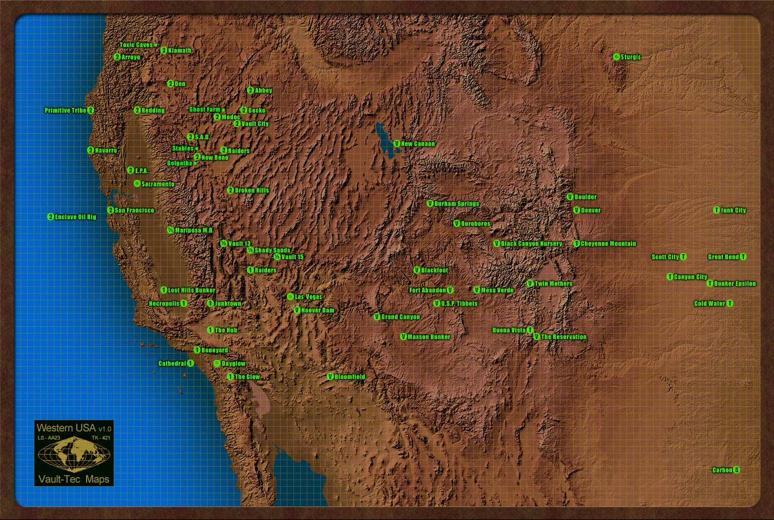
If this map is canon, then Hoover Dam is hell of alot closer to Shady Sands, the very capital of the NCR then it otherwise should be. I mean, the NCR literally have holdings as far north as San Francisco with firm control and government, but they can't seem to be able to hold onto a single city that is much closer, and not to mention that in real life, there is a highway which literally connects the area where Shady Sands should be directly to New Vegas.
Was this just a simple goof up on geography? Or did Obsidian explained the reason for the long supply line? I'm guessing the Divide was a probable reason, but I remember having to go southwards in the New Vegas map to enter the lonesome road entrance. This confuses me a bit.
- In regards to the distance between Shady Sands and Hoover Dam, the Divide could be what is limiting travel so much, just because the entrance from Vegas doesn't quite line up doesn't mean that in the past other entrances and exits didn't exist. After the bombs going off because of the courier prior to the story, any travel from the NCR would have to move around it, radiation, hostile locals and wildlife would make travel through the Divide very hard. The lack of vehicles would be another serious limiting factor for trade and travel from the NCR, after 200 some odd years, the landscape has changed quite a bit all over North America, who's to say the path that was used pre-war is no longer entirely usable? Much is left to speculation sadly, but this is the best explanation I can come up with. I hope I've helped a bit. SheasonFillyWiddler (talk) 15:38, June 22, 2017 (UTC)
--Grey Knight Dante (talk) 12:21, June 8, 2017 (UTC)